| |
|
St Paul, Norwich
Norwich and Bristol
were the only towns outside of London to be large on a
European scale during the Middle Ages. One of the results
of this is that Norwich still had 36 parish churches in
its city centre when the Reformation happened; a couple
were rapidly demolished, but most lingered on into the
20th century. Over the years, the parish function of some
fell into disuse, but a surprising number were still
parish churches of the Church of England until within the
living memory of many Norwich people.
 |
|
|
|
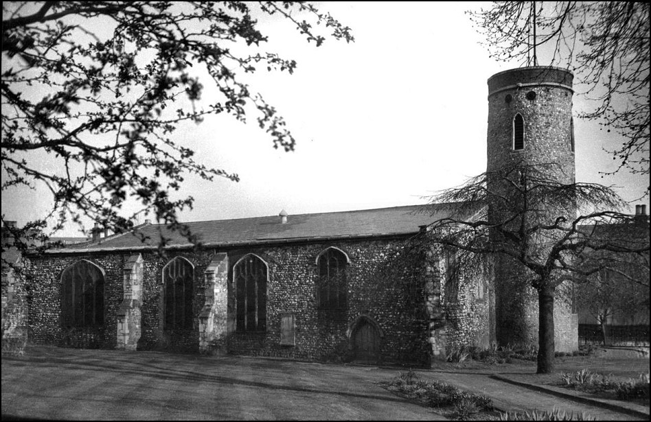
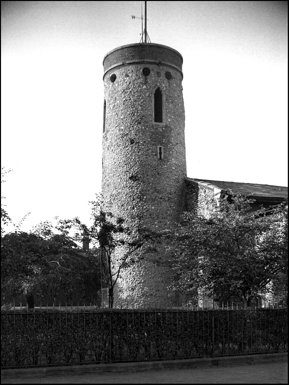
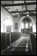
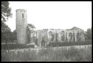
George Plunkett took the
photograph on the left in the 1930s, it shows the
church of St Paul in its pleasant tree-lined
graveyard on the northern side of the city
centre. Here in Coslany and Pockthorpe, outside
of the central commercial area, the medieval
streets had given way to factories and the
terraced houses where the workers lived. But
still the medieval churches made their presence
felt: St Paul was across the road and about 60
metres to the west along Barrack Street of St
James; barely 100 metres in the other direction
was St Saviour. All three churches remained in
use, and St Paul had the most populous parish of
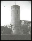
the three. Its round tower, one of five in the
city, was the biggest of them all. |
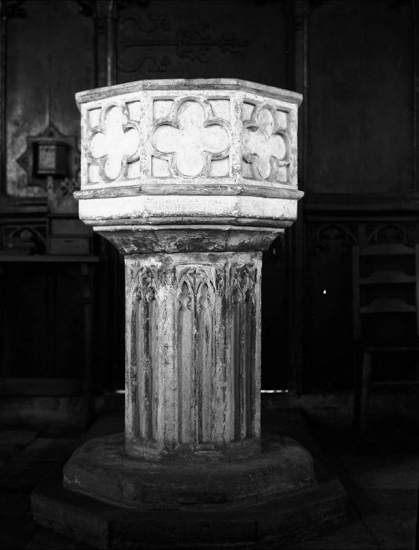
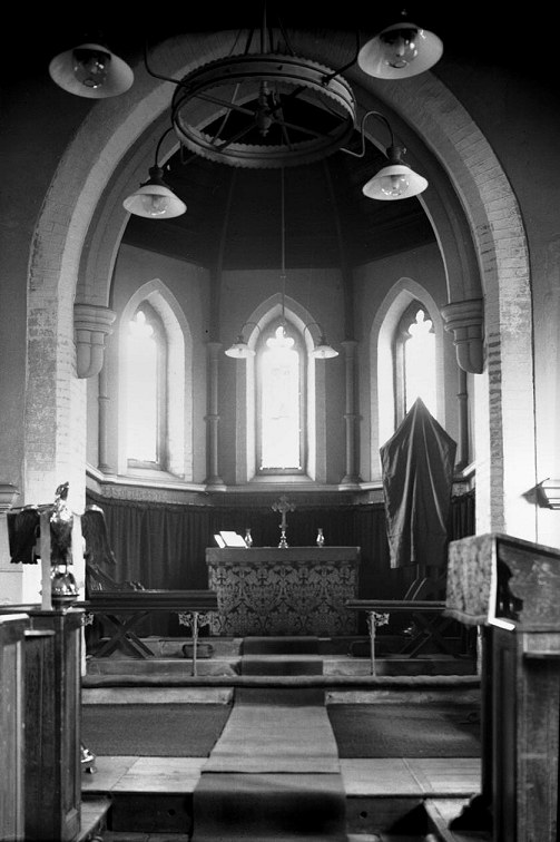
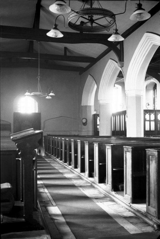
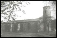
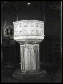
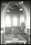
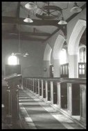
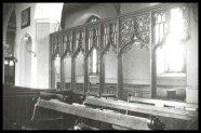
George's
photographs of the interior show a church that
was substantially Victorianised inside, but
retaining two medieval features, the 15th century
font and a parclose screen to the chapel in the
north aisle.
That
this large, aisled church no longer exists is
down to the twin-pronged nemesis of 20th century
Norwich: Adolf Hitler, Fuhrer of the German Third
Reich, and Herbert Rowley, Norwich City
Engineer-in-Chief. Between them, these two men
made sure that no trace whatsover, nothing at
all, remained of a building that was a touchstone
to generations for more than 900 years. Or,
almost nothing.
Cautley
came here after the blitz, but was still able to
see the tower, the two-storied porch and the
north aisle. This is because, contrary to what
you might expect if you've read the history of
the city, St Paul was not completely destroyed,
but burnt out by incendiary bombs. It would have
been quite possible for it to have been rebuilt
if there had been a will to do so.
|
 |
|
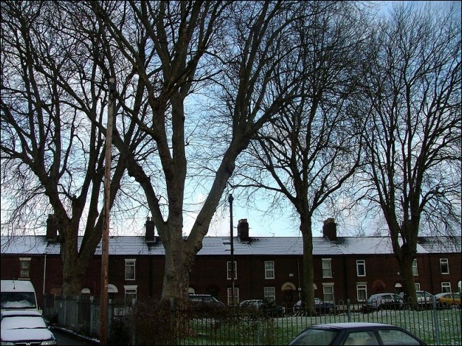
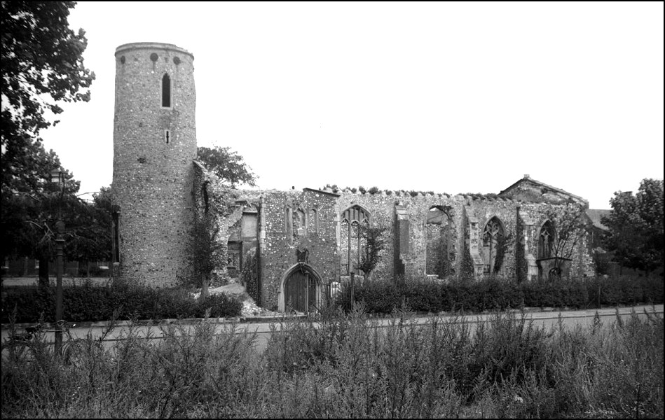
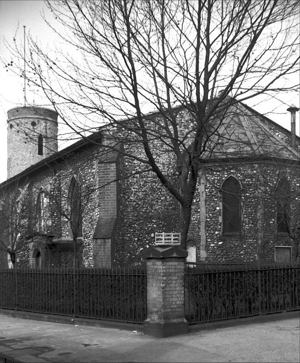
George
Plunkett's late 1940s photograph of the ruins
(left) shows St Paul as Cautley found it. George
was standing to the east of St Saviour, facing
across Barrack Street, the weeds at his feet
filling the site of a former factory. The spot
where he was standing is now a car park. St Paul
had been restored in the 19th century, a little
apse added to the chancel, but the structure is
still discernible as that of a 15th century
Perpendicular church against a Norman round
tower. There had been a little spirelet on the
top of the tower, which was burnt, but the tower
itself was completely sound, and could easily
have been kept. |
However, in the white heat of post-war
reconstruction, Herbert Rowley seized the chance to shave
a few hundred metres off of the inner-ring road. Instead
of allowing it to circumnavigate the city outside of the
medieval walls as the Norwich post-war plan proposed, so
that its northern part was beyond St Augustine, Rowley
insisted that it should make its journey further south,
cutting off the top quarter of the medieval city from the
centre. The City Station had been destroyed, and so this
was an obvious place to bend the road eastwards, cutting
Magdalene Street in two and joining up with the old road
at the Nelson Barracks corner.
The problem with this was that three
medieval churches were in the way. St James and St
Saviour had survived the blitz pretty much intact, so
Rowley put the new St Crispin's Road immediately to the
north of them, the line running along that of Barrack
Street. However, as the ring road is four lanes and
Barrack Street was only two, this necessitated widening
it, taking it across the site of St Paul.
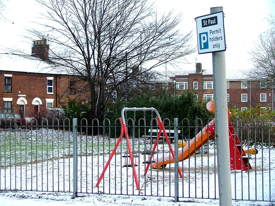
| The
church was rapidly demolished - although, as I
say, the tower need not have been - and the St
Crispin's flyover over Magdalene Street now comes
back down to earth on the site of south wall of
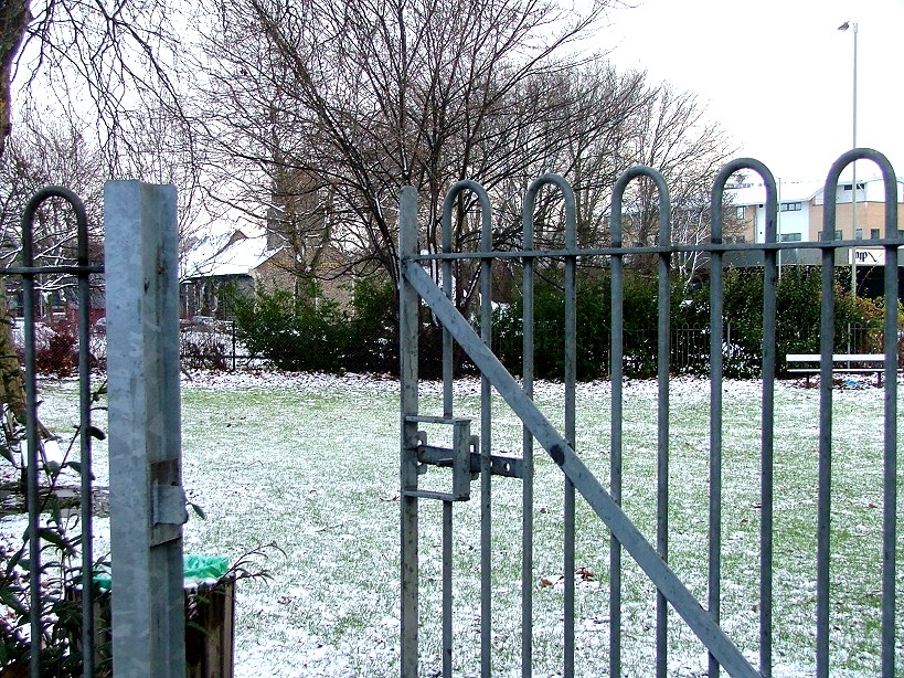
the nave. Where the tower was is now a children's
playground, and you can just make out - or is it
wishful thinking? - bumps in the ground that show
where the tower was. The two
rows of terraced houses, perpendicular to each
other, were there when the church was, and the
large trees that line the square are the only
survivors of the graveyard - they were there when
St Paul was a parish church. But that's all. And
so, Herbert Rowley's attempt to turn at least
part of Norwich into East Anglia's equivalent of
Wolverhampton began to bear fruit.
|
|
 |
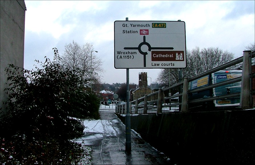
The massive urban clearway rises high above
the roof tops, coming down to intersect with the Cromer
road at a huge roundabout. St James, now the puppet
theatre, faces across the roundabout to the site of St
Paul. The two churches were so close, and yet
once terraced houses separated them.
To the north and west of the surviving
terraced rows, much of the medieval parish has now been
demolished, to be replaced by two of Mr Rowley's worst
legacies: the ugly Anglia Square shopping centre, and the
jaw-droppingly awful Sovereign House, formerly home of
Her Majesty's Stationery Office when such a thing
existed, but now standing empty. This is is simply one of
the worst examples of 1960s commercial development in
England, now a run-down, soulless concrete block. It is
completely out of scale; although it is no more than ten
storeys high, its sheer bulk imposes its arrogance on the
little streets around. I travelled widely in Eastern
Europe under the communists, but I don't think I ever saw
anything as bad there in a city of a similar size.
| When
ever I hear anyone complain about the elegant
Scottish Parliament building I want to bring them
to Sovereign House and say 'here, look at this',
and point them at this hideous, brutal block and
its ugly, ugly neighbour Anglia Square.
The current Norwich plan proposes that both be
retained and refurbished, Sovereign House as a
hotel or flats. The ghost of Mr Rowley continues
to cast a long shadow. Beyond them to the north
sits the pretty little medieval church of St
Augustine, once organically part of the medieval
city, but now so cut off from it that it might as
well be in Poland. In common with most cities
of its size, Norwich's central area has recently
been divided into zones, and this part of the
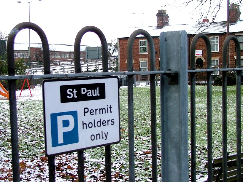
city is called 'St Paul'. And so it is that on
the parking restriction signs around the
playground, the name survives of a building that
it is almost impossible to imagine now.
|
|
 |
Simon Knott, December 2005
|
|
|